Cartographie
Date de sortie
- tous
- publiés
- 17 moins de 3 mois
- 8 moins d'un mois
Disponibilité
Prix
- 26 inférieur à 5 €
- 781 de 5 à 10 €
- 1373 de 10 à 20 €
- de 20 à 40 €
- 6 supérieur à 40 €
-

-
-

-

-
-
 Carte marine officielle "L", 7068L, 7068L DE LA PRESQU'ILE DE QUIBERON AUX SABLES D'OLONNEXxxEpshom éditions38,10
 -
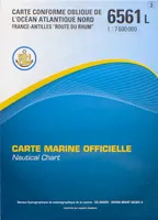 Carte marine officielle "L", 6561L, 6561L OCEAN ATLANTIQUE NORD FRANCE ANTILLES ROUTE DU RHUMXxxEpshom éditions38,10
 -
-

-
-
-

-
 Carte nationale de la Suisse, 264 T, JUNGFRAU PEDESTREXxxOffice Fédéral de Topographie Russe – OFTS23,00
 -
 Carte nationale de la Suisse, 273 T, MONTANA PEDESTREXxxOffice Fédéral de Topographie Russe – OFTS23,00
 -
 Carte nationale de la Suisse, 248 T, Prättigau / Schanfigg / Landschaft Davos 248tXxxOffice Fédéral de Topographie Russe – OFTS23,00
 -

-
 Carte marine officielle "L", 7127L, 7127L ABORDS DE L'ILE DE BREHAT ANSE DE PAIMPOL - ENTREE DU TRIEUXXxxEpshom éditions38,10
 -
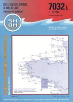 Carte marine officielle "L", 7032L, 7032L ABORDS DE LORIENT - DE L'ILE DE GROIX A BELLE ILEXxxEpshom éditions38,10
 -
Carte marine officielle "L", 7345 L, 7345L GUADELOUPE DE MONTSERRAT A MARIE-GALANTEXxxEpshom éditions38,10
-